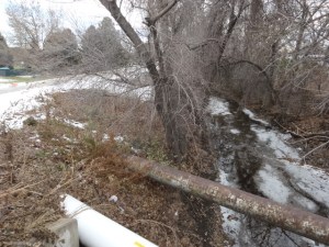
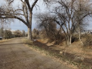
(research.) It took me a little while to figure out what I was looking at when I took a short trip to Denver and saw the 130-year-old High Line Canal. The ancient Romans might have built a straight-line aqueduct on brick arches high over the valley, but in the gold-rush days of the western plains, this constructed waterway made a more economical, but widely meandering, 71-mile journey to carry water from the South Platte River laterally across the valley. It opened in 1883 and eventually irrigated 20,000 acres of land for farming. Today, most of that land is occupied by a diverse range of communities including the southern reaches of Denver and suburbs like Littleton and Aurora. The 100’-wide corridor, still owned by Denver Water, also includes a service road that has become an attractive and highly-active route for walkers, runners, and cyclists. >> Ryan Gravel


Check out the High Line Canal Conservancy.
Map it here at its intersection with the Cherry Creek Trail.
Categories: research.
